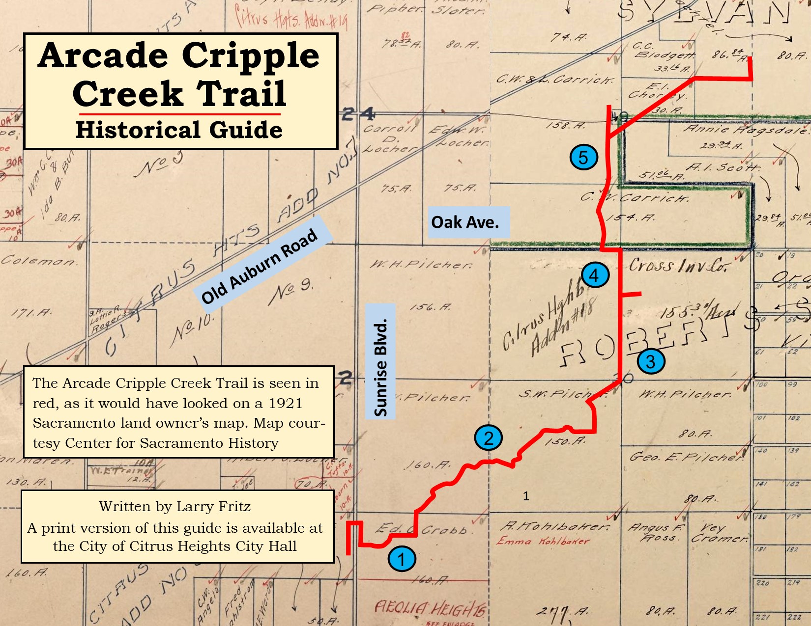
Click the button below to download a guide or continue reading.
1. Mitchell Farm
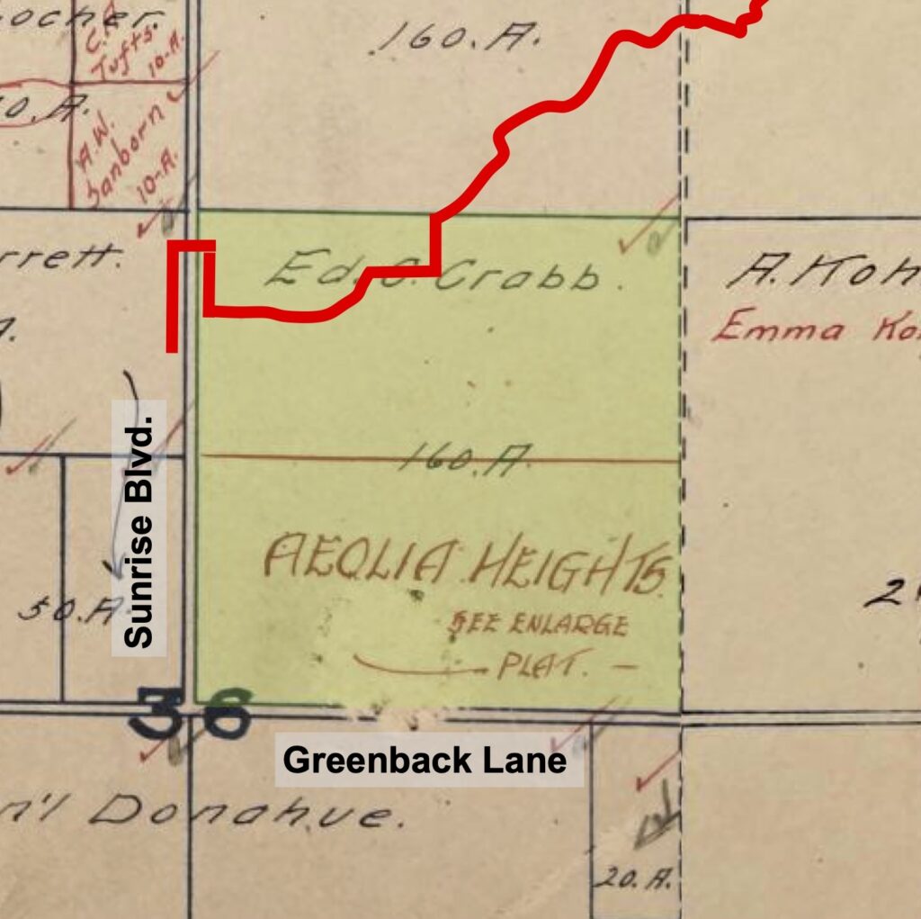
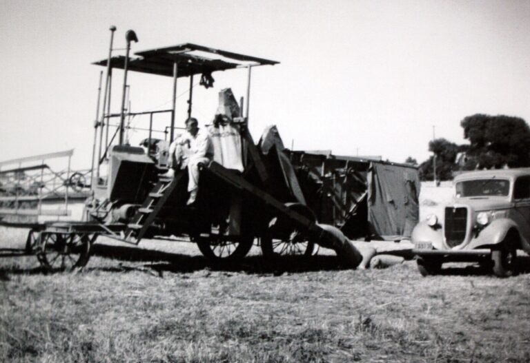
From Arcade Creek Park, the trail crosses Sunrise Boulevard. You are now on Mitchell Farm. This property was purchased in 1866 by Edward and Zenobia Crabb, who immigrated to the US from England. The Crabbs paid ten dollars an acre for the 160 acre farm. There was no irrigation at the time. Wheat, hay and other grains were the only crops that could be dry-farmed. Water for irrigation came to the southern half of Mitchell Farm in 1920.
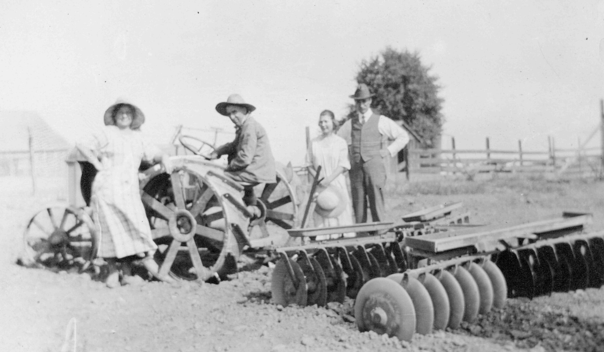
Edward Crabb Jr. planted grapes in the newly irrigated area. He also subdivided this same area into smaller parcels to sell them for a profit. He called this subdivision, “Aeolia Heights”. However, Edward Jr. never sold any of the smaller parcels. Grapes proved to be a lucrative crop, even though this was during prohibition.
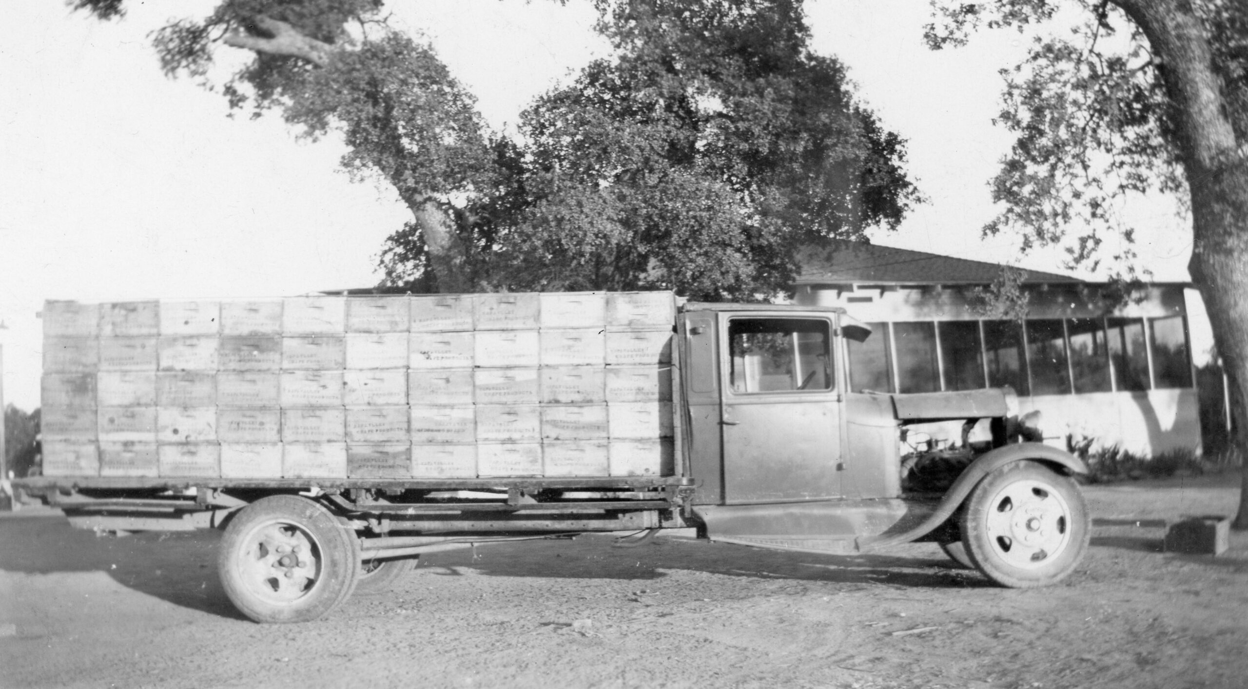
Edward Jr.’s grandson, Ted Mitchell, recalls that grape buyers would drive to the farm and load wooden boxes of grapes onto their trucks. But they would wait, sometimes for hours, until after it was dark, to leave with their load of grapes. “Pure and simple”, says Ted, “they were bootleggers. They didn’t want anyone to know where they were taking the grapes.”
2. Pilchar Farm
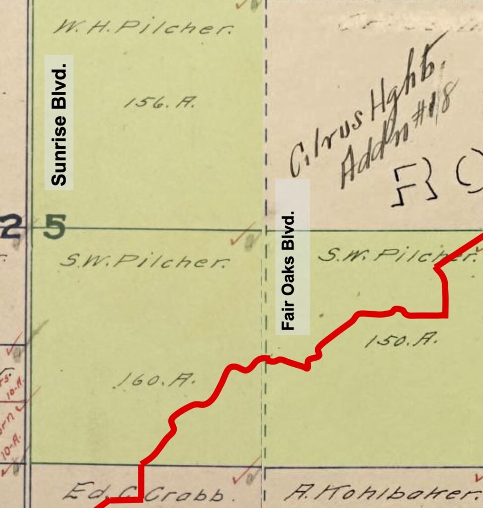
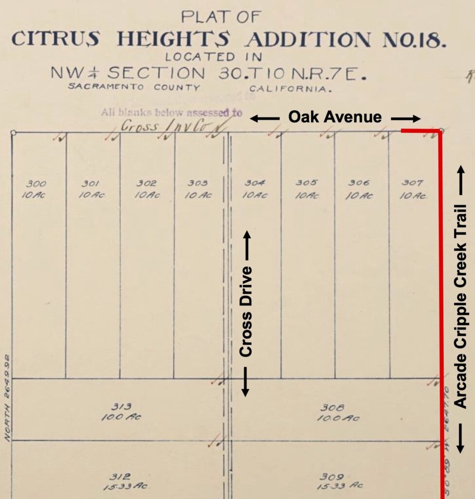
The trail turns to the north and passes the SMUD substation. You are now on the Pilchar Farm. In 1921, the Pilchars owned about one square mile, or 640 acres, of Citrus Heights farmland. 2020 census data shows the present average population density of Citrus Heights is about 6,000 people per square mile. In 1921, on this square mile of farmland, it was just the Pilchar family.
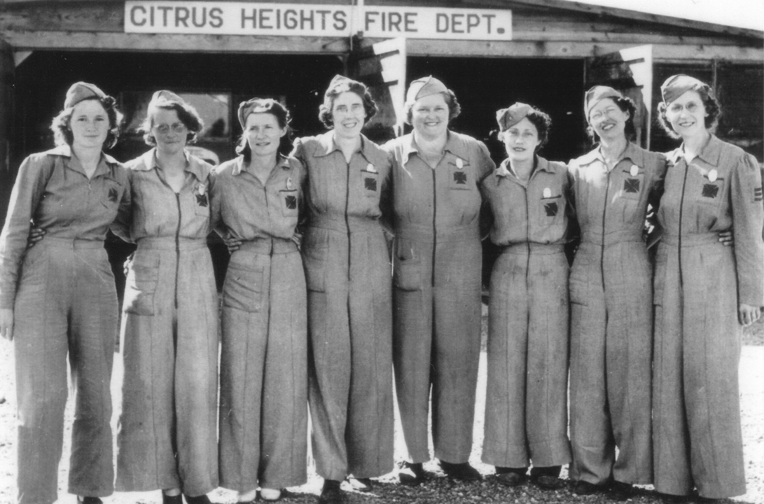
The Pilchar Farm is well-known for a barn, located at Sunrise Blvd. and Oak Ave., that caught fire on December 31, 1933. There was no fire department at the time. Bystanders watched helplessly as the barn burned to the ground. Two of those bystanders, Eugene Desimone and Virgil Mulch, formed the Citrus Heights Volunteer Fire Department a few days later.
During World War II, Eugene and Virgil’s wives, Zella Desimone and Estaline Mulch, formed the Ladies Auxiliary, a group of all-female volunteer firefighters. Along with Louise Patterson and
Mary Bost, they later formed the Ladies in White to provide emergency medical response to the area.
3. Cross Family
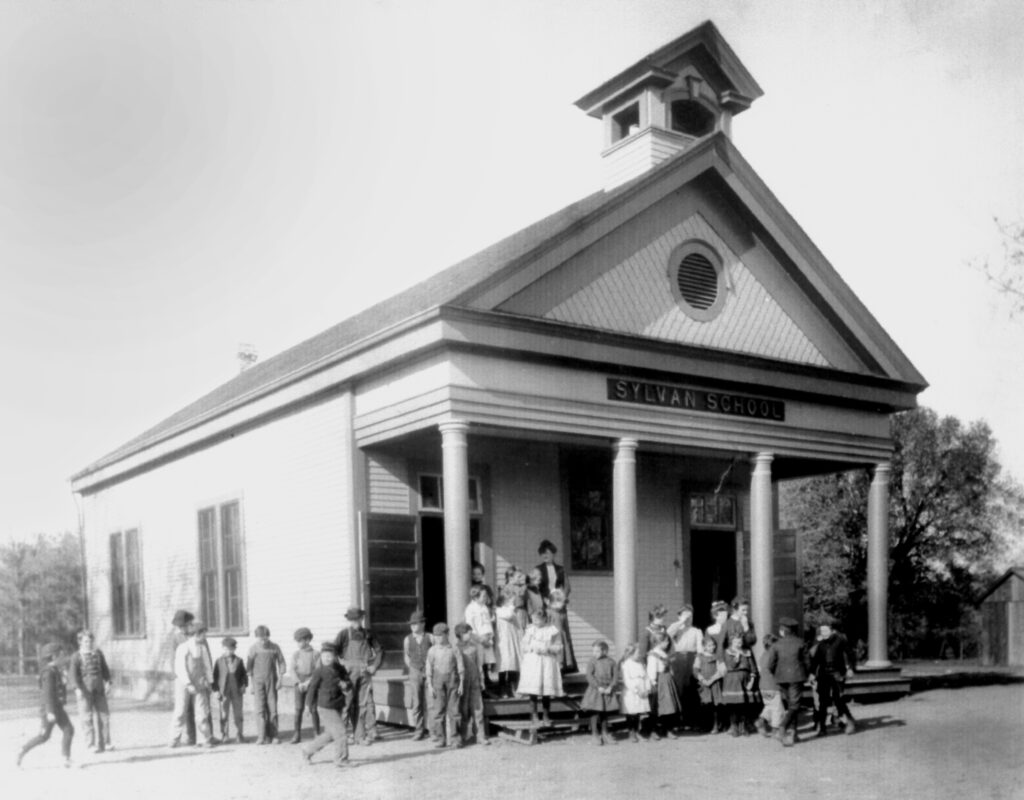
Shortly after crossing Woodmore Oaks Drive, the trail curves to the left. Streng Park is on the right. You are now on the property of John and Sarah Cross. The Cross’s came to Citrus Heights in 1862. They owned two 160 acre parcels of land, one on each side of the trail. But their main ranch and home were located on Auburn Boulevard where the Crosswoods planned community, Sylvan Library and Christ the King Retreat Center are today.
In 1862, John Cross, a carpenter by trade, helped to build the area’s first schoolhouse, Sylvan School. His wife, Sarah, was the first teacher. She taught pupils in the back of their home until the one-room school was completed.
William A. Thomas, proprietor of the 15 Mile House, donated five acres of land for the new school. This gave him naming rights. William chose the name Sylvan, which means wooded, because the area was thickly forested with oak trees at the time.
John Cross was a conservationist. He liked oak trees. According to his daughter, Lilian, he preserved every oak tree on a 100 acre parcel of land, now the Crosswoods planned community, at a time when other farmers were clear-cutting all of their land. As you pass Northwoods Park, there is a majestic Valley Oak tree on a hill near the tennis courts. This was already a mature tree in John’s time. It is one of the trees that he spared.
4. Walt Trainor
In 1921, the Cross’s sold their land on the west side of Arcade Trail to the Trainor-Desmond Company, who then subdivided the property. To provide access to the smaller parcels, Walt built a road down the middle of the property and named it Cross
Drive, in honor of the former owner. To attract buyers for the new land parcels, Walt named the subdivision “Citrus Heights”.
The area had been known as Sylvan for over fifty years. The school district, cemetery district, library and many businesses all bore the Sylvan name. In 1910, Walt Trainor developed his first subdivision south of Greenback Lane, across the street from where San Juan High School would soon be built. He named it “Citrus Heights”. A newly formed water district and a prominent community organization adopted the Citrus Heights name. Soon, the area itself was referred to by both names for many years.
In June 1947, the area received its’ first post office, located in what was then the main shopping center on Mariposa Avenue, where Hall’s Furniture is today. The powers-that-be named this new post office “Citrus Heights”. From that point on, if you wanted to receive mail, you lived in “Citrus Heights”, not Sylvan.
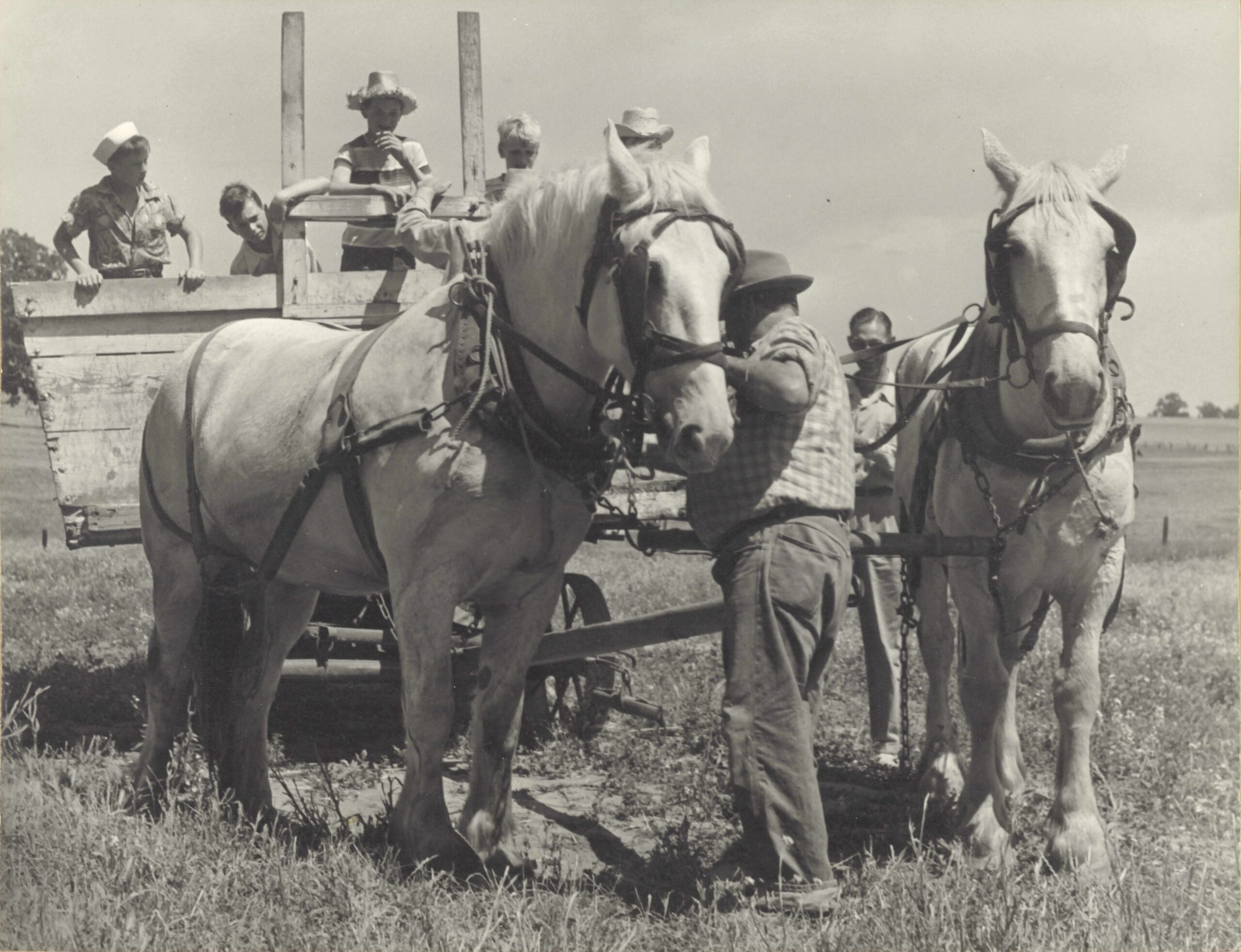
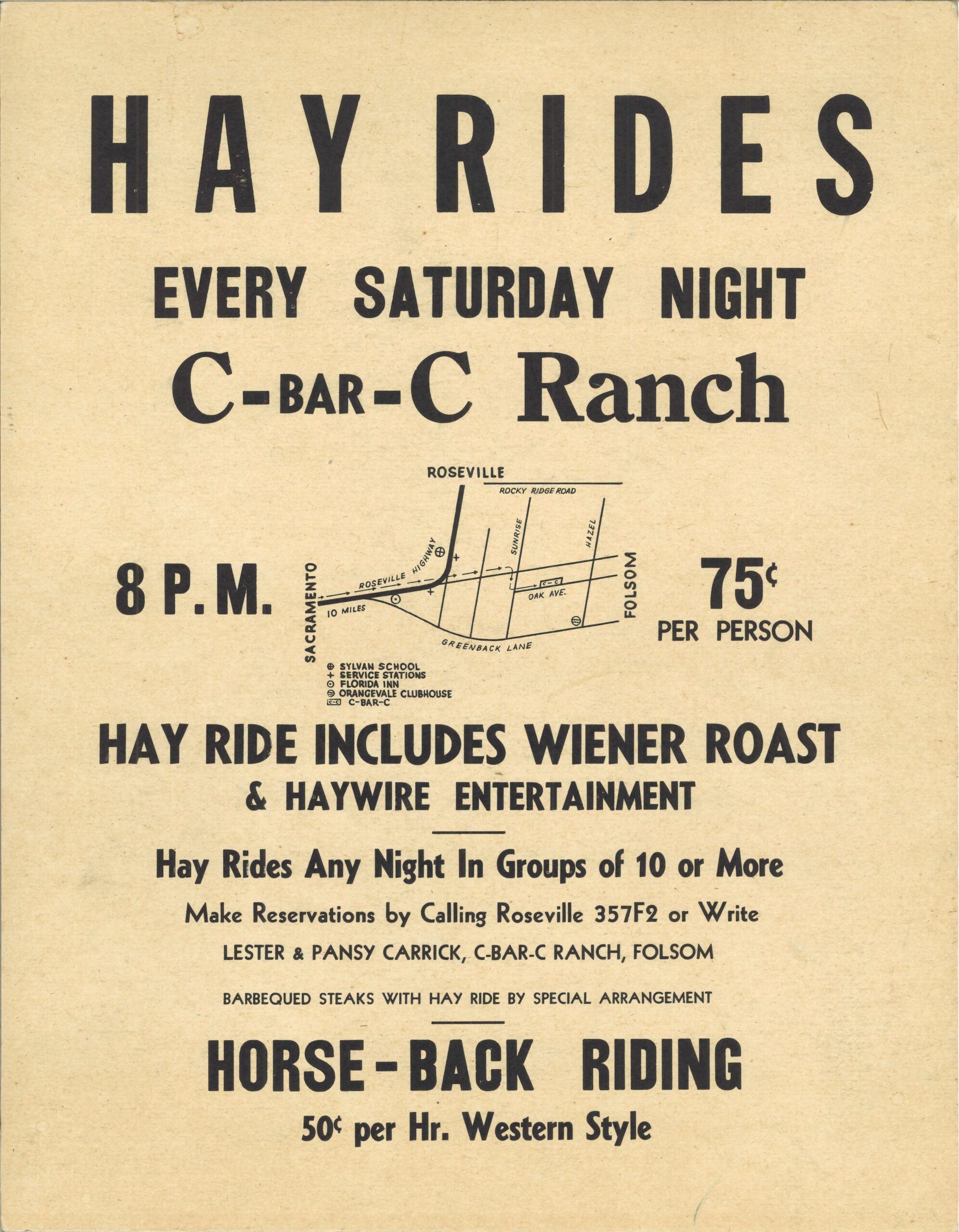
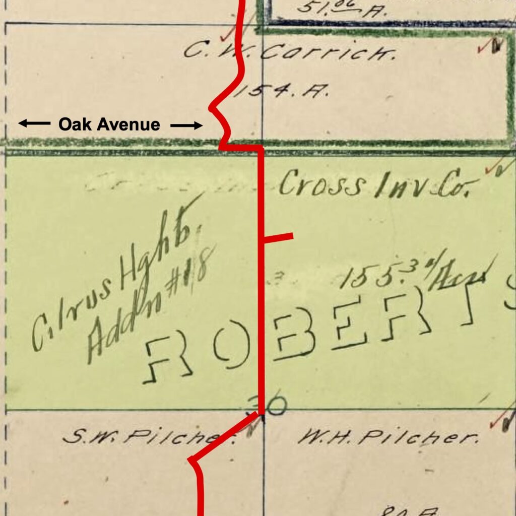
5. C-Bar-C Ranch
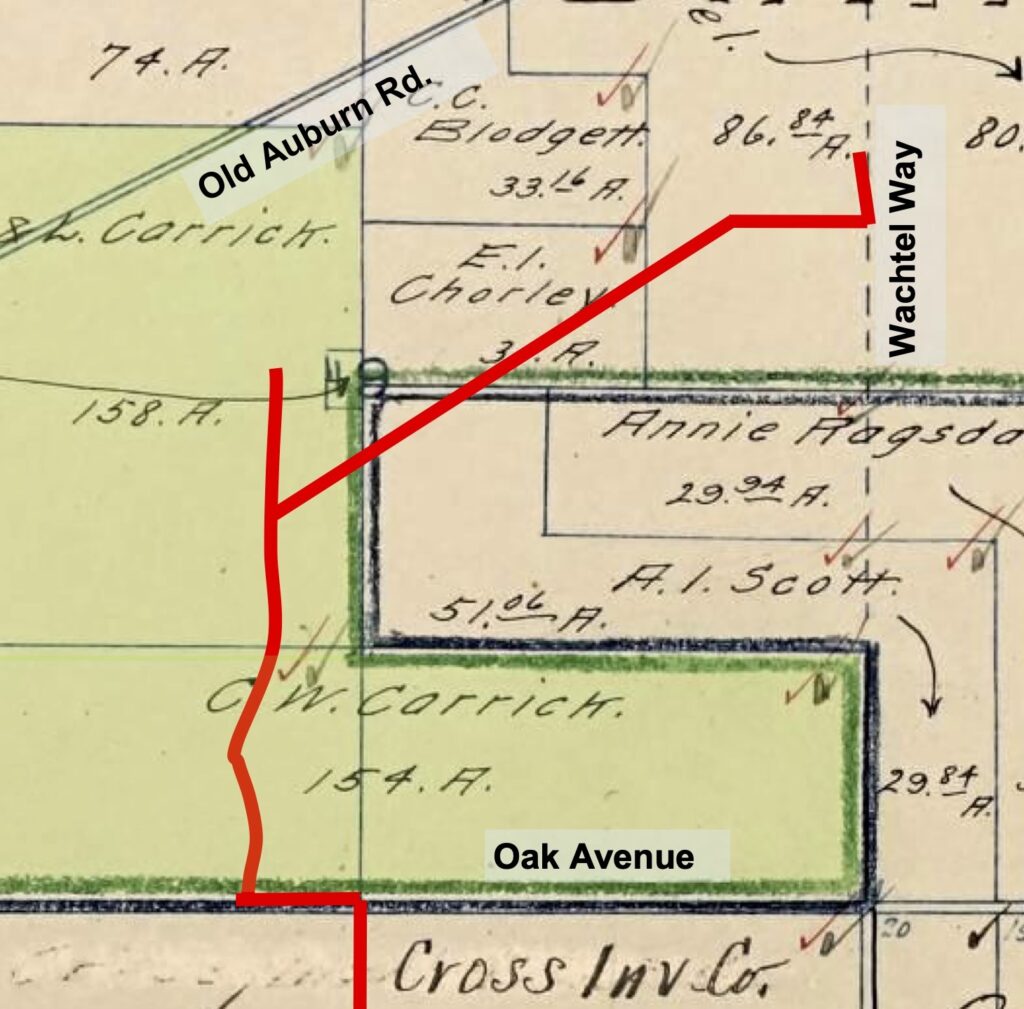
From Northwoods Park, the trail crosses Oak Avenue. You are on the Carrick family farm, known as C-Bar-C Ranch. William and Bridgett Carrick bought 320 acres here in 1873 and started to farm. Their nephew, Lester Carrick and his wife, Pansy, continued the farming tradition. Pansy was also the school nurse at
San Juan High School for many years. Lester and Pansy were instrumental in the creation of C-Bar-C Park.
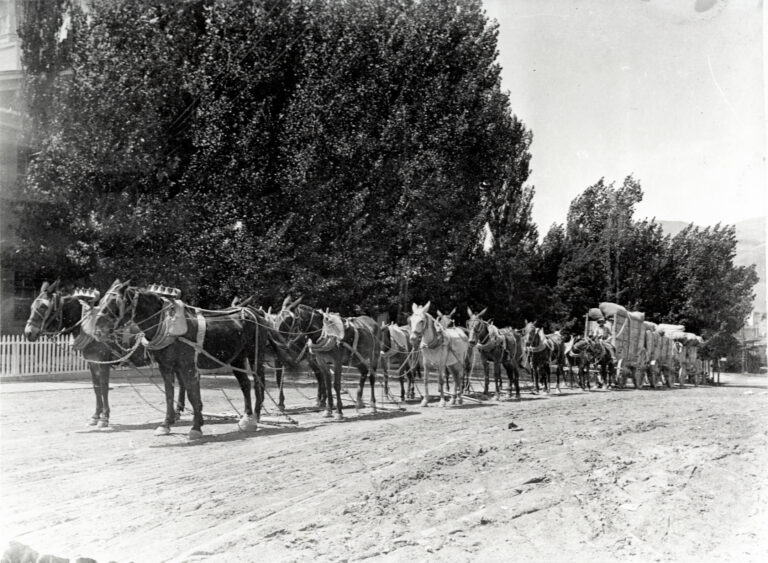
C-Bar-C Ranch is best known for its hayrides, barbeques and outdoor entertainment activities. Horse-drawn wagons drove on public streets. From Oak Avenue, the wagons followed Old Auburn Road to Mariposa, then Watson Way to Sunrise Blvd. One young wagon driver, Richard Kniesel, recalls that flashlights were hung from the rear of the wagons as taillights on night rides, and after every hay ride, Lester Carrick treated his helpers to an RC Cola from Tom Thumb Market.